Saturday, February 13, 2010

Day 7 - Dalgety - Bega

Saturday 13th February 2010

Well it rained hard all last night and I really was hoping that it would be dry today - no chance. It was drizzling when I woke up at 7am so I went back to sleep for another hour, by then it was raining harder. If I’d been in a more interesting place it would have been very tempting to take the day off, however Dalgety had very little to offer in the way of attractions, and with no access to the internet or even a mobile phone signal, it was time to move on. I waited until the rain eased off a bit around 10 am then set off on the road to Nimmitabel, about 50kms away. The route took me across classic Monaro country, wide vistas with the Snowy Mountains in the distance, occasional clumps of granite boulders interrupting the huge expanse of pasture grass. Unfortunately the driving rain made me in no mood to enjoy the view, let alone take many photographs - this was the only one I managed:


Most of the way to Nimmitabel was along a gravel road and the wetness made the going quite slow. I reached Nimmitabel around 2.30 and had an excellent fettucine at the café there; although there was no wifi access in this small town, the café owner very kindly allowed me to use her internet dongle for a few minutes so I could let everyone know I was okay - having not been able to post any updates to the blog for nearly 3 days I figured that some people might be worried, in view of the remoteness of the country I had just traversed.

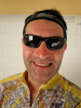
Wet and miserable in Nimmitabel.
There was nothing to detain me in Nimmitabel though, so despite the continuing rain I set off again and soon found myself on the Snowy Mountains highway, going down an exhilarating (and dangerous in view of the wet) winding descent down Brown Mountain, from about 1390 metres down to virtually sea level. Both brakes were jammed full on all the way down and I was grateful for the consideration of the woman driver behind me who took it upon herself to provide rear cover from other traffic on this treacherous descent.

The rest of the way to Bega was rolling countryside and the going was pretty good, despite the continuing rain; by this time I’d stopped worrying about it - at least once I was down off the Monaro plateau the temperature warmed up a bit. I eventually arrived in Bega at 7.30 and found a comfortable motel, enjoyed a good hot shower and set about drying all my clothes out - fortunately the plastic bags inside my bike panniers had kept all the luggage fairly dry.

Total distance covered today - 111kms - not bad in view of the adverse weather conditions.

Day 6 - Jindabyne - Dalgety

Friday 12th February 2010

After yesterday’s hard ride I woke at 8am to the sound of heavy rain outside, so went back to sleep for a couple more hours. It was still showery so I had a bit of a wander around Jindabyne shopping centre checking out all the ski shops, then when the rain eased off a bit more I rode along the bikepath around the lake and saw the impressive memorial to the explorer Strezlecki, who first named Mt Kosiusko, Australia’s highest peak, which is nearby.


Lake Jindabyne bike path.

By about 1130 it was dry so I set off heading east towards Dalgety along a very quiet, gently rolling road. This is the Monaro high country, characterised by natural grasslands at an altitude of around 1000m. It’s very open country and a prime area for sheep grazing.


I reached Dalgety, about 35kms away, at 1.30, crossing over the Snowy River via a historic bridge. Dalgety is now a very small town with a pub, a garage and a post office/café, but strangely it was once under consideration to become the Australian national capital, before Canberra was decided upon. At the time of these deliberations, a century ago, the Snowy was a mighty river, however following the Snowy Mountains Hydro-Electric scheme, a huge project providing electricity and irrigation water involving the construction of a series of dams diverting most of the flow to the Murray and Murrumbidge systems, it’s now little more than a stream:


Dalgety's Post Office and Cafe

Since I’d not had any breakfast, I enjoyed a very nice trout salad at the local café. Unfortunately while I was there the rain started again, much heavier this time. I waited until about 4pm at the café waiting to see if it would stop, but no luck. I knew that there was nowhere to stop before Nimitabel, some 50kms away and part of this would be along a dirt road, I had no lights and knew I wouldn’t make it to Nimitabel before dark, reluctantly therefore I decided to stop in Dalgety, the only accommodation being in a caravan park on the banks of the Snowy River which had some fairly basic cabins. At least there was a pub nearby, so I settled in for a quiet evening, hoping that the weather would improve enough for me to make up the lost distance tomorrow.
Total distance covered today (including the ride around Jindabyne lake) - a disappointing 40kms.


Day 5 - Gelantipy - Jindabyne

Thursday 11th February

Knowing that I either had to make it to Jindabyne, 136kms away, or be prepared to sleep rough without a tent, I made a very early start; I was on the road by 5.45am, shortly before daybreak. It was fantastic watching the dawn from this wild, remote road:


Shortly after dawn I came across some cattle straying across the road, seemingly unsupervised. There was no danger of them being run into by motor vehicles though; there was no traffic.


After about 20kms I came across the Seldom Seen Roadhouse, which appeared to have closed for good, presumably owing to the lack of clientele:


Although there were a number of vehicles outside, in varying states of disrepair, and a bizarre sculpture made of old bicycles suspended between 2 trees, there was no sign of life there:


Shortly after Seldom Seen the C608 to Jindabyne, otherwise known as the Barry Way, commences. This road was completed as recently as 1961, although work on it had commenced back in the 1920s. It has very little traffic; all day I saw fewer than a dozen other vehicles. It’s tarmaced for the first 10km then becomes a dirt road for the next 70kms.


After 40kms I reached Suggan Buggan, where there is a river, a small campsite (with no facilities) and nothing else. After Suggan Buggan there was a big climb up to the Monaro Gap from where there were some fantastic views, before a steep descent and some short climbs through open pine forest.


The road descends to, and follows along, the Snowy River, and the views got better and better:


After about 60kms I reached the marker of the border between Victoria and New South Wales:


…The road continued to follow the Snowy River until its confluence with Jacobs River at 83kms, where I stopped for lunch at the very basic campsite, and had a swim and rested for an hour before the next section which I knew was going to be tough. 3kms out of Jacobs River the road ascends for 15 solid kms. Ideally I would have like to tackle this section early on in the day but having to stay at Gelantipy meant that it was inevitable it would be reached in the heat of the afternoon. And hot it certainly was. I’d filled up all my water bottles at Jacobs River but I only had a total of 2.5 litres carrying capacity and this had to last until Jindabyne, another 55kms away because there were no more rivers on the way.


Lunch at Jacob's River.


After lunch it took me about 3 hours to cover the 15km ascent, walking most of the way, it was too steep and I was too tired to pedal it. It was a real hard slog, made bearable only by the knowledge that there was no alternative but to reach Jindabyne, and also the reward of increasingly spectacular views:


The highest point of the road was 1343metres altitude. After about 105kms the road became sealed tarmac, which was a relief; however I still had 30kms to travel that day and by now the light was fading. Still I pressed on, I didn’t have a front light and there was virtually no moonlight, so the last 15kms or so were in almost total darkness. Fortunately the sealed road had good clear white markings which I was able to follow.

I eventually reached Jindabyne at about 9.45pm and checked into the first accommodation I saw, at the Alpine Gables Hotel. No food was available so I had to make do with some crisps and a large beer before falling very soundly asleep.

Total distance today 139kms - not the longest of the route so far, but certainly the hardest.

Alpine Gables, Jindabyne


Day 4 - Bairnsdale - Gelantipy

Wednesday 10th February

I managed to get an early start, leaving Bairnsdale around 6.30am. The route started along the main Princes Highway, fairly quiet at that time in the morning. After 10km I reached the small town of Nicholson where I had a quick breakfast; from here I was able to follow another section of the bike path along the former East Gippsland Railway:

A1 Princes Highway is to the right of the picture.

Soon I was crossing the wide Nicholson River:

The rail trail was a delight to follow; it was tarmaced most of the way to Bruthen, about 20km away.


Towards Bruthen the tarmac ran out but the unsealed surface was still quite good and smooth to ride on:


At Bruthen I stopped at this charming old general store for a cold drink:


There were no further stopping points until I reached Buchan, another 48ks further on. The road went past Mt Nowa Nowa and became increasingly undulating; it was also very hot. Shortly after Bruthen I saw this road sign which was the first I’d seen on the journey to give the distance to Sydney:


I stopped for a late lunch in the pretty village of Buchan. The LP guide informed that this is the last town on the route until Jindabyne, 176kms away. There was also only one place to stay before Jindabyne and that was Gelantipy, about 40kms further on. The LP guide recommends that the section between Buchan and Jindabyne be tackled over 3 days, camping at 2 stops en route, at Suggan Buggan and Jacobs River. I didn’t have a tent with me and didn’t want to carry camping equipment; my plan therefore was to stay overnight at Gelantipy and attempt to make the final 136 kms to Jindabyne in one hit, the following day.


Shortly before 6pm I crossed Gelantipy Creek and arrived at the accommodation at Karoonda Park, a former timber mill, now a farm with cabin accommodation. Apart from a large school party I was the only guest there, and I enjoyed an excellent roast dinner before retiring early to a very comfortable bed. I knew that the next day was going to be a big challenge, the 136kms to Jindabyne had no facilities whatsoever en route so I had to take all the food I needed with me; I knew there were rivers on the way where I could get drinking water but that was literally all there would be.

Karoonda Park.
Total distance today - 132kms.


Tuesday, February 9, 2010

Day 3 - Traralgon - Bairnsdale

Tuesday 9th February 2010


A rather late start today; by the time I’d spent an hour or so replying to emails and having breakfast it was about 9.30 by the time I was on the road north heading out of Traralgon towards Maffra. It was already getting hot, too.

Having deviated somewhat from the Lonely Planet recommended route I was intending to rejoin it at Sale, some 60kms east of Traralgon. Instead of taking the main A1 Princes Highway between these two towns I had intended to ride along the Gippsland Rail Trail, a cycle path along a disused railway which formerly linked Traralgon with Stratford, via Maffra and Heyfield. I’d picked up a guide to the trail from the tourist office which said that the surface of the trail was suitable only for mountain bikes, but had gradually been upgraded and the last section would be suitable for all bikes.


Quick drink stop at Toongabbie - already very hot

The railway trail was never far from the C460 road so I checked it at frequent intervals but the surface, while it did gradually improve, never reached a good enough standard to tempt me away from the road, which was well surfaced and had only minimal traffic. I’m going to have to ride plenty of miles on unsealed roads later in the route and I don’t want to shred my tyres unnecessarily.

Another monument to early explorer Strezlecki at Heyfield, 25kms from Traralgon

Mc Alister river, outside Maffra


Mc Alister hotel, Maffra


Maffra main St. A very well kept small town with some interesting historic buildings.


Metropolitan Hotel, Maffra


At Maffra the surface of the disused railway trail improved somewhat and I rode it for a few kms but it got rough again so I returned to the main road.


The rail trail finishes at Stratford, which is, unsurprisingly, on the river Avon (below) which was somewhat dried out today:
I had lunch in Stratfiord by which time it was already well into the afternoon, it was still very hot and the LP route to Bairnsdale, through remote country via Stockdale and Lindenow, would have been another 77kms; instead I went straight down the main A1 highway which wasn't all that busy and had a good wide shoulder - on which I came across this echidna perilously close to the road:
I also saw a couple of kangaroos but couldn't get the camera out quickly enough to photograph them.
This short cut saved about 25kms so I arrived in Bairnsdale about 6.30pm, having ridden 136kms today. I checked into a very comfortable motel and enjoyed a good fish and chips at the Main Hotel, washed down by a very agreeable Shiraz Cabernet Sauvignon.

This ugly water tower is a distinctive feature of Bairnsdale's main street.
Bairnsdale is at the easternmost end of the Latrobe valley; tomorrow I'll be commencing the ascent into the Alps, so I had better get a good night's sleep and I hope to be on the road early to miss as much of the heat as possible.


Monday, February 8, 2010

Day 2 - Inverloch - Traralgon

Monday 8th February

Having had an excellent night’s sleep I was on the road by 7.30 after carbo-loading on a large banana muffin from the Inverloch bakery. It was already quite warm and it wss obviously going to be a scorchingly hot day. Rather than follow the LP route to Foster and Balook via the Tarra-Bulga national park, I decided to head up the Bass Highway as far as Mirboo North then fork off along a minor road to Traralgon, via Boolarra and Churchill. None of these were on the LP itinerary but I wanted to revisit Traralgon, since I’d spent several months living there back in 1997.
The Bass Highway has a good wide shoulder and made for safe cycling, though it was quite undulating, going over the Strezelecki ranges. After 25kms I reached Leongatha, a pleasant small town with some attractive historic buildings:


After gulping down a quick drink I rode on through the increasing heat. The terrain got more and more undulating and it was quite tough going, but at least the road surface was good and there was very little traffic.


After another 25kms I reached Mirboo North where the only thing of note was this monument to Count Strezelecki, one of the first to explore the region.

Strezlecki monument at Mirboo North

This was at the highest point of the Grand Ridge Road which runs along the top of the Strezlecki range.

From Mirboo North there was a long descent to Boolara, then another series of climbs towards Churchill, then the rest of the way to Traralgon was pretty flat. On arrival I checked into the Governor Gipps Motel, on the busy Princes Highway, and made straight for the pool to escape the 35 degree heat.


Traralgon’s quite a big town, with around 20000 inhabitants and is spread out over a wide area. It has an attractive post office dating back to 1886 but otherwise has very little of note. Being a Monday very few restaurants were open and none of the bars seemed to be serving after about 9pm, the place was like a ghost town. Fortunately my room had plenty of cold beers in the mini bar and there was a Domino’s just up the road, otherwise I’d have starved. It was interesting to see Traralgon again after 13 years but I won’t be in a hurry to return.

Traralgon Post Office
Distance covered today -121kms - so making reasonable progress!